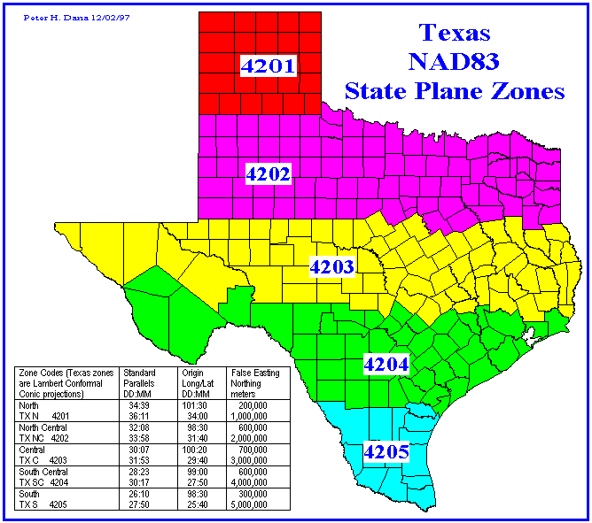
Zones or FIPSZones
The main aim in creating the SPCS was to design a conformal mapping system for the entire country while maintaining a maximum scale distortion of 1 part in 10,000. In 1933 this was considered the limit of surveying accuracy. In order to attain this accuracy, the larger states needed to be divided into smaller zones or FIPS. Each zone or FIPS has its own central meridian or standard parallels to maintain accuracy. FIPS stands for Federal Information Processing Standard. The State of Texas is divided into 5 FIPSZones.